Forward Loop Software LLC
Software Applications & Software Engineering Services
FLVfrTerrain
The FLVfrTerrain application is a flight planning tool intended to supplement a pilot's current planning tools. Its purpose is to help general aviation pilots choose a Visual Flight Rules (VFR) route above terrain of the lower forty-eight contiguous states of the USA. It is not for in-flight navigation, but instead is for the planning phase before a flight.
NOTE 1: Forward Loop Software LLC does not have the resources to verify the accuracy of the terrain and airport data, so the FLVfrTerrain application cannot be a pilot's primary flight planning tool. The pilot must use FAA Sectional Maps to confirm that the chosen flight plan avoids dangerous terrain, towers, power wires, and other obstacles not shown by the app.
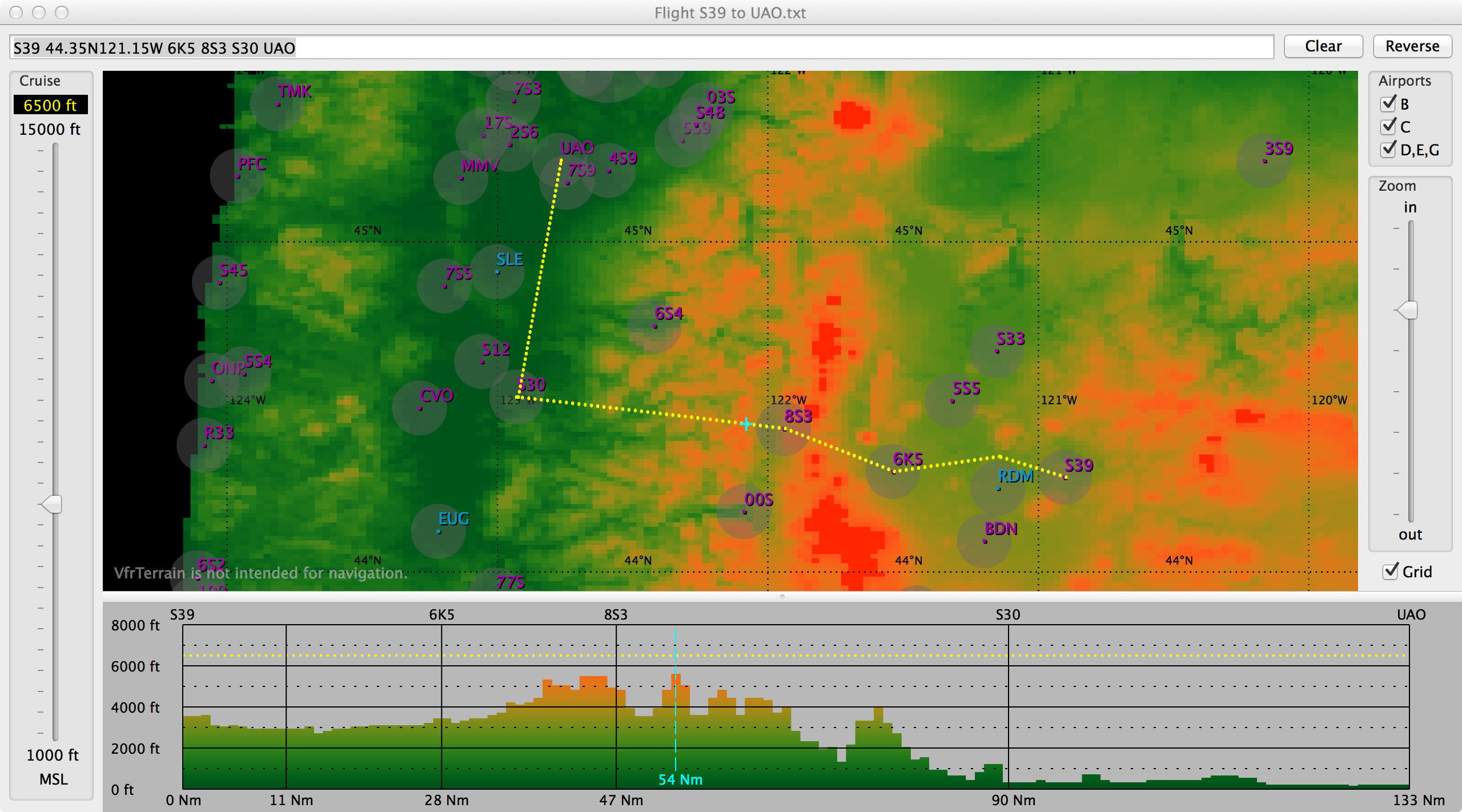
The screenshot above shows a flight from Prineville to Aurora in Oregon. The pilot experimented with various routes to reduce the peaks in the terrain profile view and thereby reduce the minimum cruise altitude. The profile showed that an altitude of 6500 feet should clear the highest terrain of the Cascades along the flight path. (Of course wind and weather conditions may require a higher altitude, due to turbulence, downdrafts, or obscured terrain.)
NOTE 2: The airport airspace circles shown on the terrain map are very rough approximations of the actual airspace boundaries, so the pilot must plan with FAA Sectional Maps to avoid inadvertent airspace violations.